Whenever the subject of streetcars came up in conversation, my Mom would always remind me that I rode on one in Minneapolis. Since the last car ran in June of 1954, I would have been only a year old at most. But she, like anyone else old enough to remember the Twin Cities’ streetcars (please don’t call them trolleys), knew it was important to remember that part of local history and wanted me to know that I had been a witness to it.
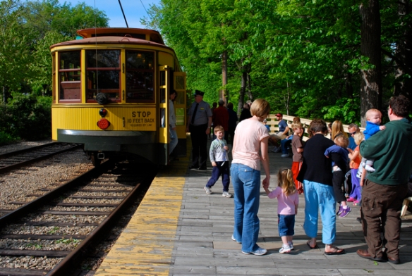
A short section of the old Como-Harriet streetcar line operates as a tourist attraction. (photo by Steve Date)
Minneapolis and St. Paul had one of the best public transportation systems in the country for the first half of the 20th century. It began with horse-drawn cars in the 1870s and a brief period of flirtation with cable cars and steam engines in the 1880s.
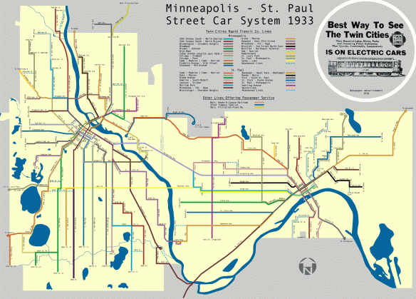
When electricity finally emerged as the power of choice in the early 1890s, the system blossomed and ridership took off. By the 1920s, an elaborate and extensive web of track covered the Twin Cities metropolitan area. According to the Minnesota Streetcar Museum website, there were 524 miles of track at the peak, stretching all the way from Stillwater to Lake Minnetonka, Anoka to Hastings.
Within the cities of Minneapolis and St. Paul, more than two-dozen lines were spread out in such a way that most residents had to walk no more that a few blocks to catch a streetcar.
Streetcars remained a preferred mode of transportation through the depression and WWII. But in 1949, a group of investors took control of the Twin City Rapid Transit Company (which by now included buses), and the end was in sight. Buses were becoming more cost-effective than rail and driving a car to work had become a big part of the American dream.
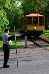 The Twin Cities’ streetcars were fairly quickly shut down and sold to other cities for use or sold as scrap metal. On June 19, 1954, the last Minneapolis streetcar ran on the Como-Harriet line.
Thankfully, in 1971, a group of individuals and the Minnesota Transportation Museum had the foresight and the funding to reconstruct about a mile of the track and refurbish some of the cars as a historic tourist attraction — a living museum.
Many people now enjoy riding the historic Como-Harriet streetcars and the volunteer operators love to tell the history of this line and the rest of the streetcar system. It’s a great way to spend a little time as part of a visit to Lakes Harriet and Calhoun.
The current ride stops abruptly on the southeast shore of Lake Calhoun, at the spot where the old Lakewood Cemetery Station used to be. I’m sure I’m not the only one who thinks about where the track used to go after that as it headed toward downtown Minneapolis.
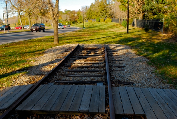
Current section of track ends abruptly at Lake Cahoun, but it used to continue across 36th street on its way downtown. (photo by Steve Date)
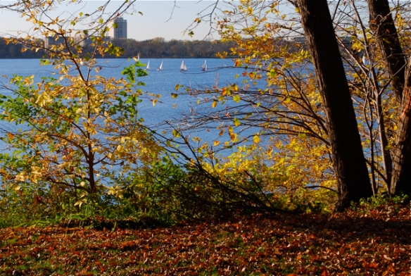
I had forgotten about my Mom telling me about riding the streetcar until this week when I was poking around over by Lake Calhoun, following the old track bed to see where it went. From seeing old photos, I knew there used to be a bridge over 36th Street and then the line continued up the side of Lake Calhoun for a couple of blocks. This is now a beautiful walking path, covered in wood chips, with views through the trees of the lake below.
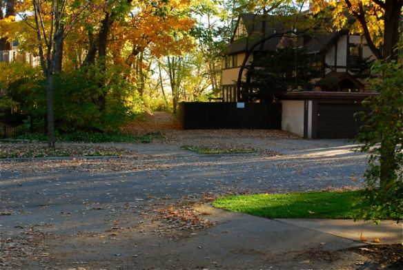
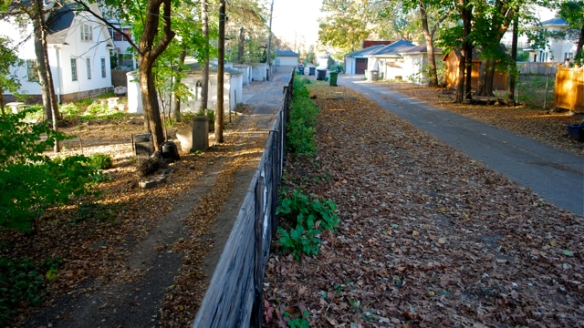
Streetcars emerged from the woods where the walking path is now behind this house at 34th St. near Lake Calhoun and continue up the alley where I'm standing. (photo by Steve Date)
I never really knew where the track used to go after it emerged from the woods at 34th St. Then, I read on the marker at the end of the current line that it ran next to an alley between James and Irving Avenues between 34th and 31st Streets, eventually making its way onto Hennepin Avenue.
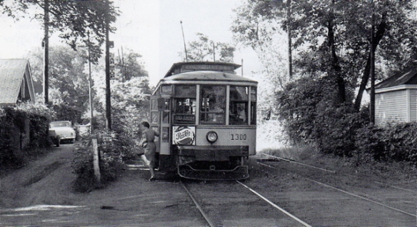
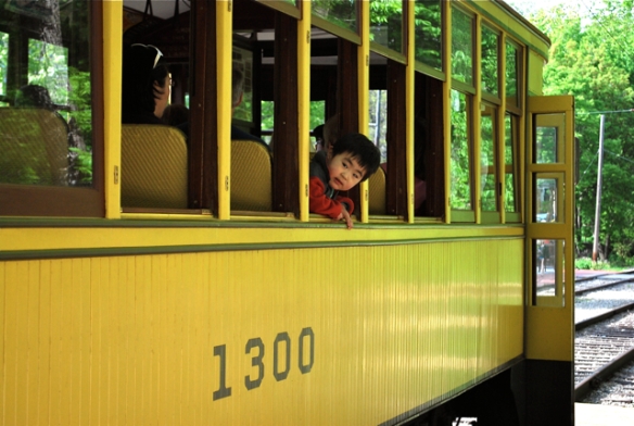
Streetcar #1300 (one of the preserve cars in use today at Lake Harriet) lets a passenger off in the alley between Irving and James Avenues at 33rd St. (photo by Bob Schumaker for THE COMO HARRIET STORY, a book by Aaron Isaacs and Fred Rhodes, produced by the Minnesota Transportation Museum, 1997)
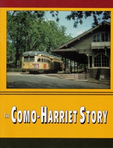
A very nice book with lots of old photos by by Aaron Isaacs and Fred Rhodes for the Minnesota Transportation Museum (1997)
The Como-Harriet line must have been one of the most scenic routes in the city. Passengers enjoyed views of the lakes, a beautiful cemetery, a residential alley that opened up into the bustle of Hennepin Avenue and then on to downtown Minneapolis. We’re lucky to have a mile of it preserved so we can experience a small taste of what it was like.
I know there are quite a few other remnants around of other lines around town. Now that I’m tuned in to looking for them, I’m looking forward to taking my map and exploring some of the other routes.
As I see the popularity of our new light rail line grow, with plans for more routes to be added, I think about what we once had here and feel sad that it all had to be destroyed before we realized what a great thing it was. But I guess good ideas have a way of coming back around.
Thanks, Mom, for reminding me about my streetcar trip. Even though I don’t remember it, I haven’t forgotten.

If you go to 31st and Irving, in Uptown, you will see a building with a curved front. Built that way because that’s where the streetcars turned the corner. The house on the other side of Irving built its garage right on the vacated ROW.